| |
The Peace Lowland Ecoregion | |
| |
|
|
| |
|
|
| |
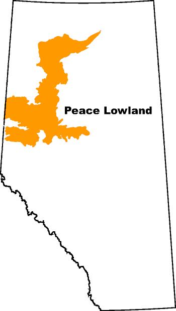
 | A large area of gently undulating lands in the northwestern part of Alberta. It covers more than 5 million hectares or about eight percent of the total area of the province (Ecological Stratification Working Group 1995). It has a low boreal ecoclimate with greater heat in the summer than the surrounding uplands. Mean annual precipitation ranges from 350 to 600 mm per year. The region as a whole has a slight heat limitation for annual cereal grains and oilseeds and the north-central area is also rated with a slight moisture limitation (Pettapiece 1989). Soils are described as Dark Gray Luvisols, Solods and Chernozemic, all of which are associated with clayey lacustrine parent material. These soils have developed under mainly deciduous forests of aspen and popular.
Agricultural Ecoregion in Alberta |
|
|
| |
|
|
| |
Other Documents in the Series |
|
| |
The Peace Lowland Ecoregion - Current Document
The Boreal Transition Ecoregion
The Aspen Parkland Ecoregion
The Moist Mixed Grassland Ecoregion
The Fescue Grassland Ecoregion
The Mixed Grassland Ecoregion
|
|
| |
|
|
| |
For more information about the content of this document, contact David Spiess.
This document is maintained by Laura Thygesen.
This information published to the web on August 1, 2001.
Last Reviewed/Revised on July 20, 2016.
|
|