| |
Guide to Field Experimentation: Site Location | |
| |
|
|
| |
|
|
| | The location of a project site often makes or breaks a project. Proper location can reduce the effect of natural variability on project results and optimize plot accessibility and visibility. When selecting your site location, consider:
- soil variability
- site topography
- site drainage
- site access
- site visibility
- suitability of the cooperator
Soil variability
Soils are inherently non-uniform. Characteristics that are variable or cause variability include:
- texture
- permeability
- variability of subsoils
- salinity
- chemical and fertilizer application history
- dead furrows, turn-rows, and headlands
- former fence lines and field boundaries
Select a uniform and representative portion of the field for your project site. If variability cannot be avoided, minimize its effects by:
- using long and narrow plots running in the direction of the greatest soil variation. This encompasses as much of the variability in the field as possible without exposing the whole field to the treatment.
- determining the cropping and management history of the field.
- collecting samples for fertility and salinity testing.
Site topography and drainage
The site characteristics should be as representative of your area as possible. Keep away from headlands and field entrances. The site should be well drained and should not have any watercourses running through the plots. Try to select simple slopes. Locate the site in a midslope position to avoid the effects of soil erosion and deposition. If more than one site is being selected and you want to compare results, ensure that the slope aspect (i.e., the direction in which the slope faces) is the same at all sites.
Site access
All types of vehicles, from tour buses to tractors, need access to the site. Access should not be limited by poor weather. Farmers should be able to stop at any time and walk to the site. Establish and maintain walkways to and around the site. Spring-seeded winter wheat is often used for walkways as it has a low growth habit.
Site visibility
Locate the site so it can be seen from main roads. If it can be seen from a kilometre or more away, there is more time for the driver's curiosity to build and more time to plan a stop or slow down. Projects located near stop signs benefit from the fact that a farmer driving by must come to a stop there.

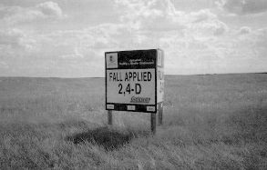
Main sign used at an experimental site
|
|
| |
|
|
| |
Other Documents in the Series |
|
| |
Guide to Field Experimentation
Guide to Field Experimentation: Planning a Field Experiment
Guide to Field Experimentation: Experimental Design
Guide to Field Experimentation: Site Location - Current Document
Guide to Field Experimentation: Project Implementation
Guide to Field Experimentation: Data Collection
Guide to Field Experimentation: Awareness and Technology Transfer
Guide to Field Experimentation: Evaluating Effectiveness of Awareness
Guide to Field Experimentation: Reporting
Guide to Field Experimentation: Summary and Conclusions
Appendix: Examples of Applied Research and Demonstration Topics
|
|
| |
|
|
| |
For more information about the content of this document, contact Len Kryzanowski.
This document is maintained by Laura Thygesen.
This information published to the web on February 11, 2002.
Last Reviewed/Revised on January 16, 2019.
|
|