| | Ralph Wright, manager of the agro-meteorological applications and modelling section with Alberta Agriculture and Forestry, analyzes the data.
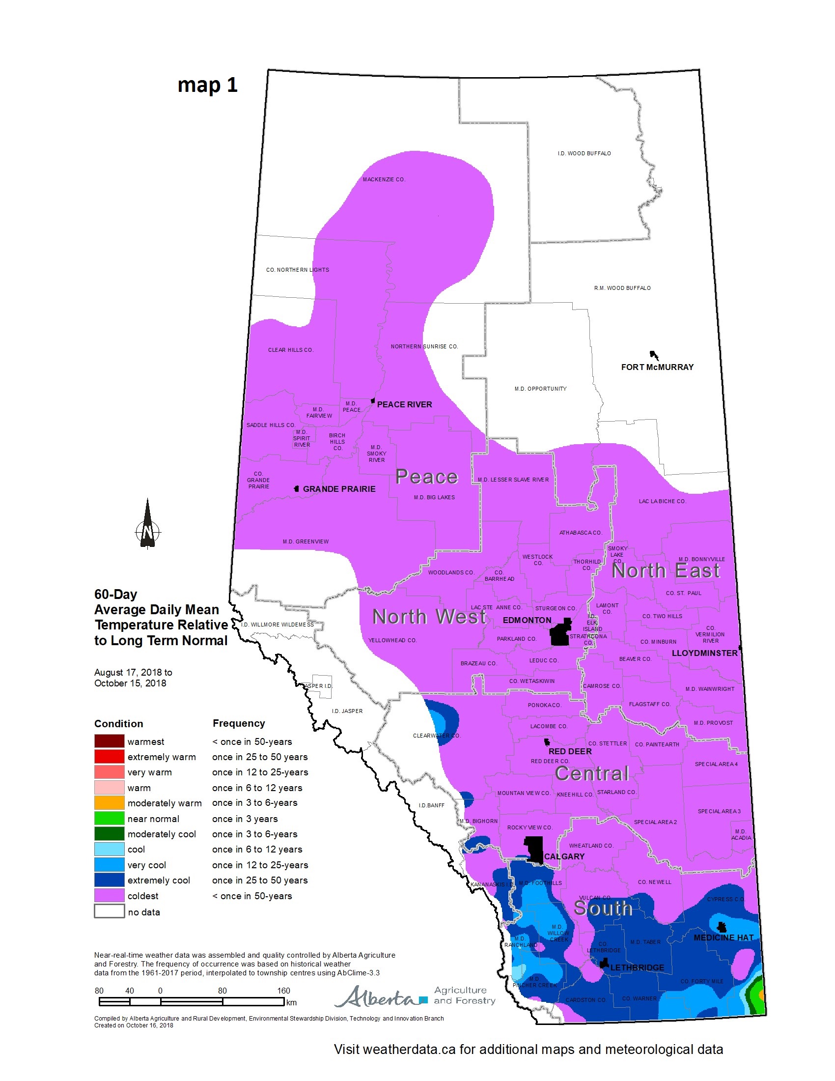
“August 24, 2018 marked the start of a seven week-long cold spell that affected most of Alberta, and it finally ended on October 15,” says Wright. “This was indeed a rare event, estimated to occur on average less than once in 50 years (map 1)."
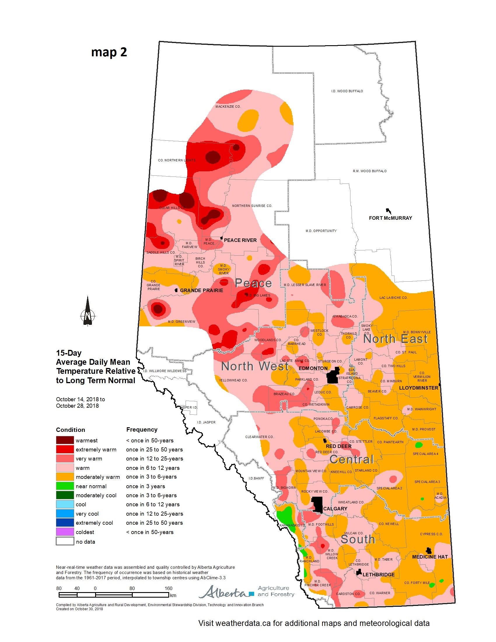
"October 15 saw the reversal of this cold trend with the arrival of warmer than average temperatures that persisted for the rest of the month (map 2). Fortunately, the late October spell stayed dry allowing many to make significant progress in their harvesting operations.”
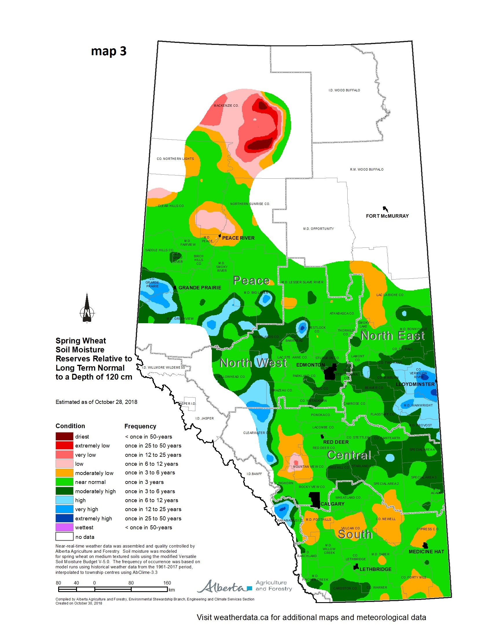
Wright says that for many areas, the cool weather in September and early October was relatively wet, allowing soil moisture reserves to rebound. “It was aided by low evaporative demand brought on by cool weather and several frost and snow fall events that all but shut down active growth. As a result, current soil moisture reserves are at least near normal across most of the province (map 3). However, dry conditions still persist across parts of southern Alberta where some areas are experiencing one in three to six year lows for soil moisture. A small pocket of less than one in 50 year lows were present across the northern Peace Region, in the lands in and around La Crete.”
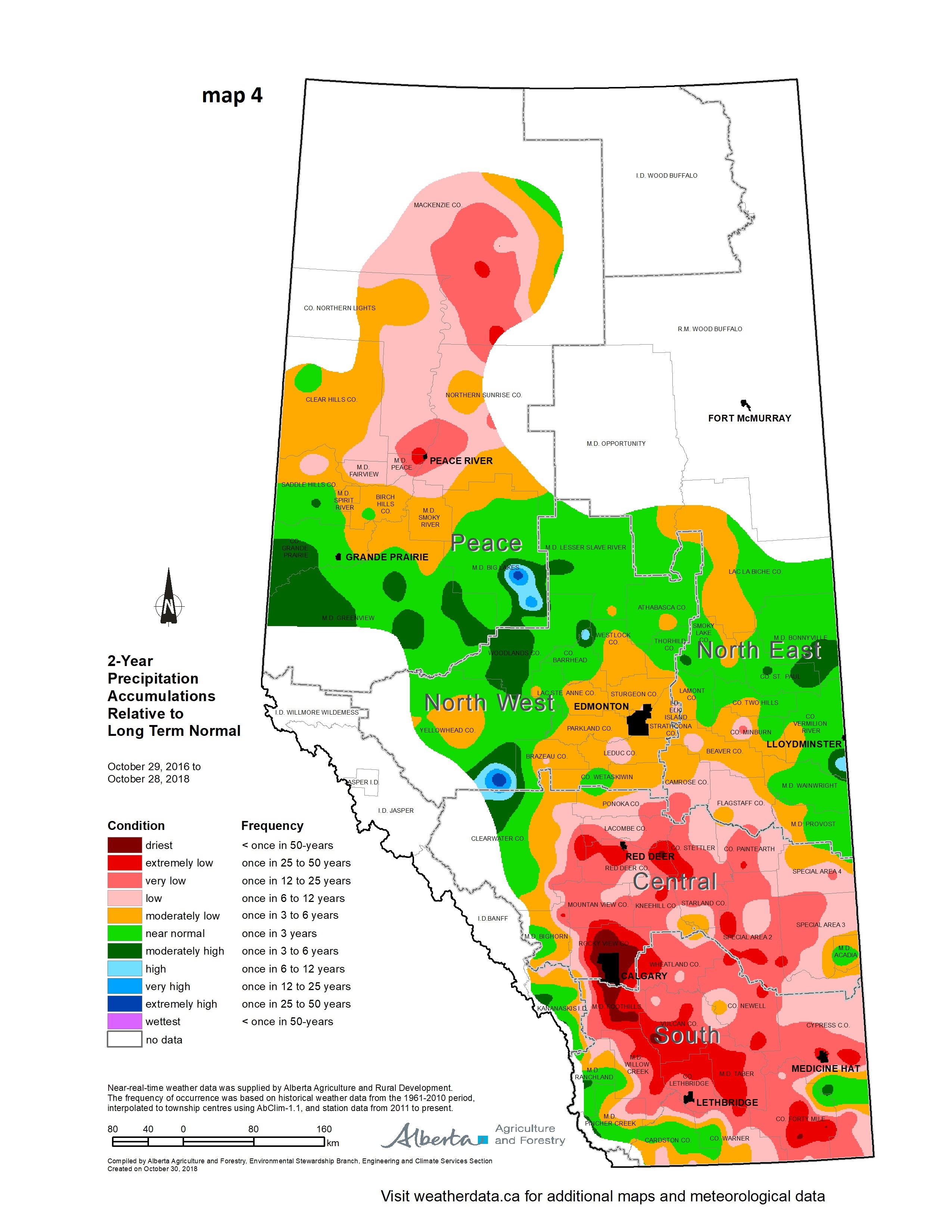
“The short term moisture situation has improved for most when looking back over the past two years,” he explains. “However, there still are long term moisture deficits that exist across a wide area stretching from near Red Deer to the U.S. border (map 4). These deficits are greatest in and around Calgary – with one in 50 year lows. They extend down a wide corridor that sweeps just north of Lethbridge and extends down into parts of the extreme southeast corner of the province. Here, several areas are in the 25 to 50 year low range. In addition, most of the north half of the Peace Region has been overall drier than normal over the past two years, with some areas experiencing one in 12 to 25 year deficits. From a cropping perspective, these longer term deficits may not affect crop production, provided that next year’s rains are near normal and occur in a timely fashion.”
“Winter will soon be upon us and long range forecasts are mixed with some pointing to a possible El Ni�o year. This is typically thought to be associated with a warmer and drier winter, but Mother Nature often does not hold to our ‘rules.’ Alberta is a geographically highly-varied province, and rarely is a single trend expressed across the entire province, over a period of several months. At this point it really is anybody’s guess as to what the winter will bring and there is still ample time to make up moisture shortages ahead of next year’s growing season.”
Find more information at weatherdata.ca, Agricultural Moisture Situation Updates, or contact Ralph Wright, manager of the agro-meteorological applications and modelling section at 780-446-6831.
Contact:
Ralph Wright
780-446-6831
|
|