| | Ralph Wright, manager of the agro-meteorological applications and modelling section with Alberta Agriculture and Forestry (AF), analyzes the data and looks back at September.
Synopsis:
“This September has been exceptionally cold, and for many lands west of Highway 2, unusually wet,” says Wright. “As of October 3, our weather was stuck in a stable blocking pattern, drawing cold arctic air into Alberta. Unseasonably cool weather is expected to persist for at least the week of October 7. Beyond that, some forecast models are showing a warming trend while others are not. Suffice it to say, weather forecasts beyond five days are not consistently accurate, and it is not unusual to see abrupt shifts in weather patterns. Currently, the long range forecasts are mixed with some pointing to a developing El Ni�o bringing a warmer than average winter and the Farmers’ Almanac predicting a colder than average winter - take your pick.”
Wright says that for those who are thinking this was the worst September in memory, it may be true depending on how good your memory is and where you are in the province. ”For Edmonton, this September ranks as the third coldest, looking back as far as 1961. The coldest was 1965, followed only eight years later in 1972 by the second coldest September. It has been more than 50 years since Edmonton has seen a September this cold. In both 1965 and 1972, the weather in October warmed significantly with several days above 15 C recorded in both years, followed by winter snow packs that were both above average.”
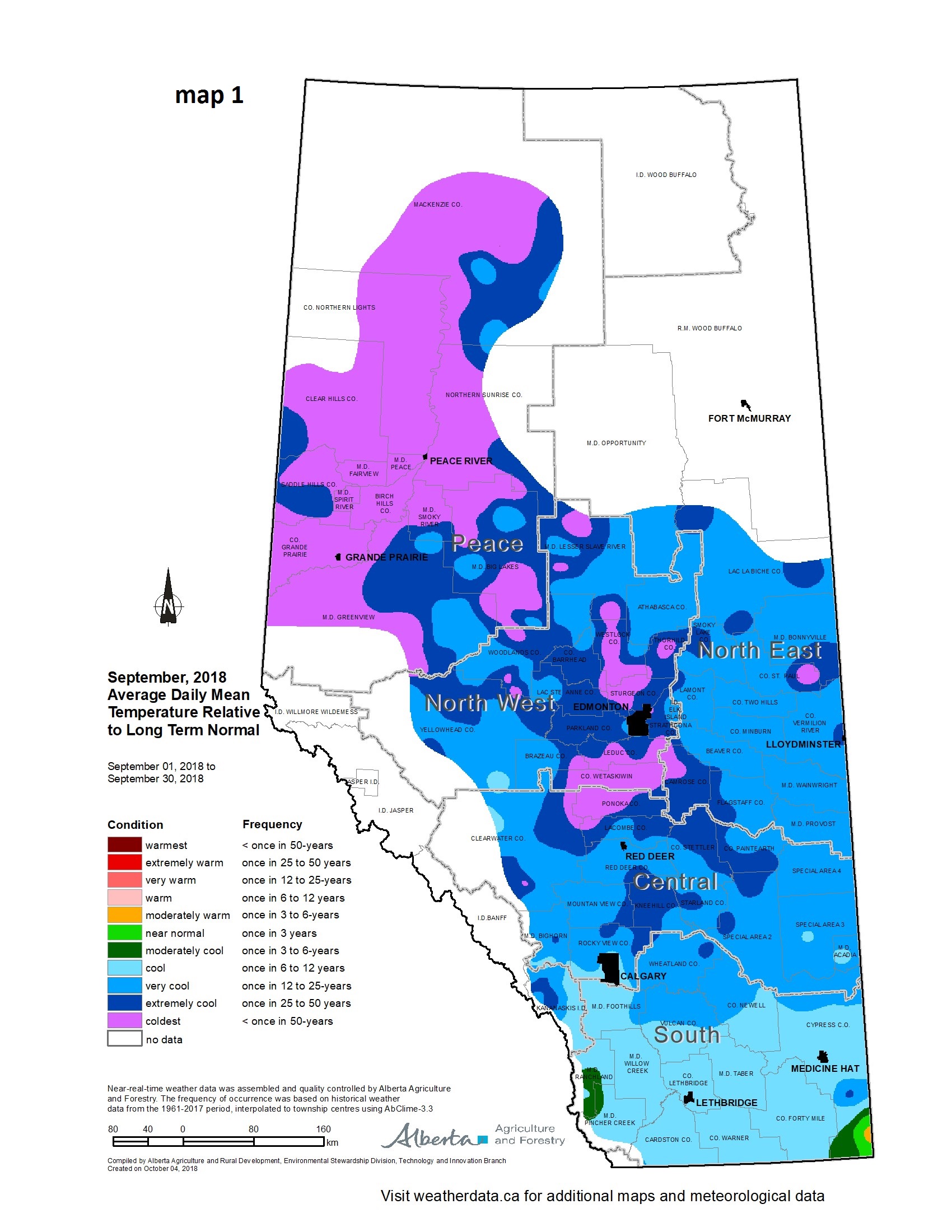
Across the entire province temperatures for September ranged from less than one in six year lows across the south, to less than one in 50 year lows across most of the Peace Region (see map 1). Says Wright, “In the early morning hours of October 3, temperatures dipped well below -10 C in the Calgary area, following a significant snowfall event. Elsewhere on this same day, few areas in the province escaped a killing frost, with most dipping below -4 C for several hours.”
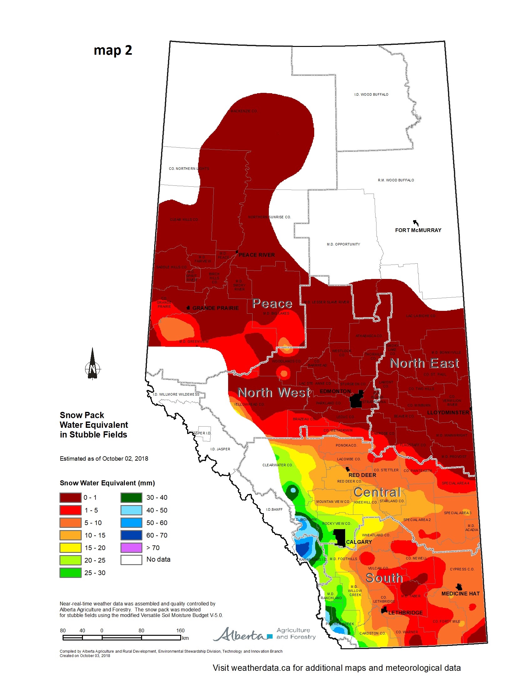
Over the first few days of October, a large snowfall event blanketed areas of the province between Ponoka and the U.S. border. This system was centered near Calgary (see map 2) and upwards of 30 to 40 cm of snow fell. “Snowfall amounts generally increased westward with some high mountain stations recording over 70 mm of precipitation. It may be upwards of a metre of fresh snow given that the snow was very light and ‘fluffy’ and fuelled by extremely cold air aloft,” adds Wright.
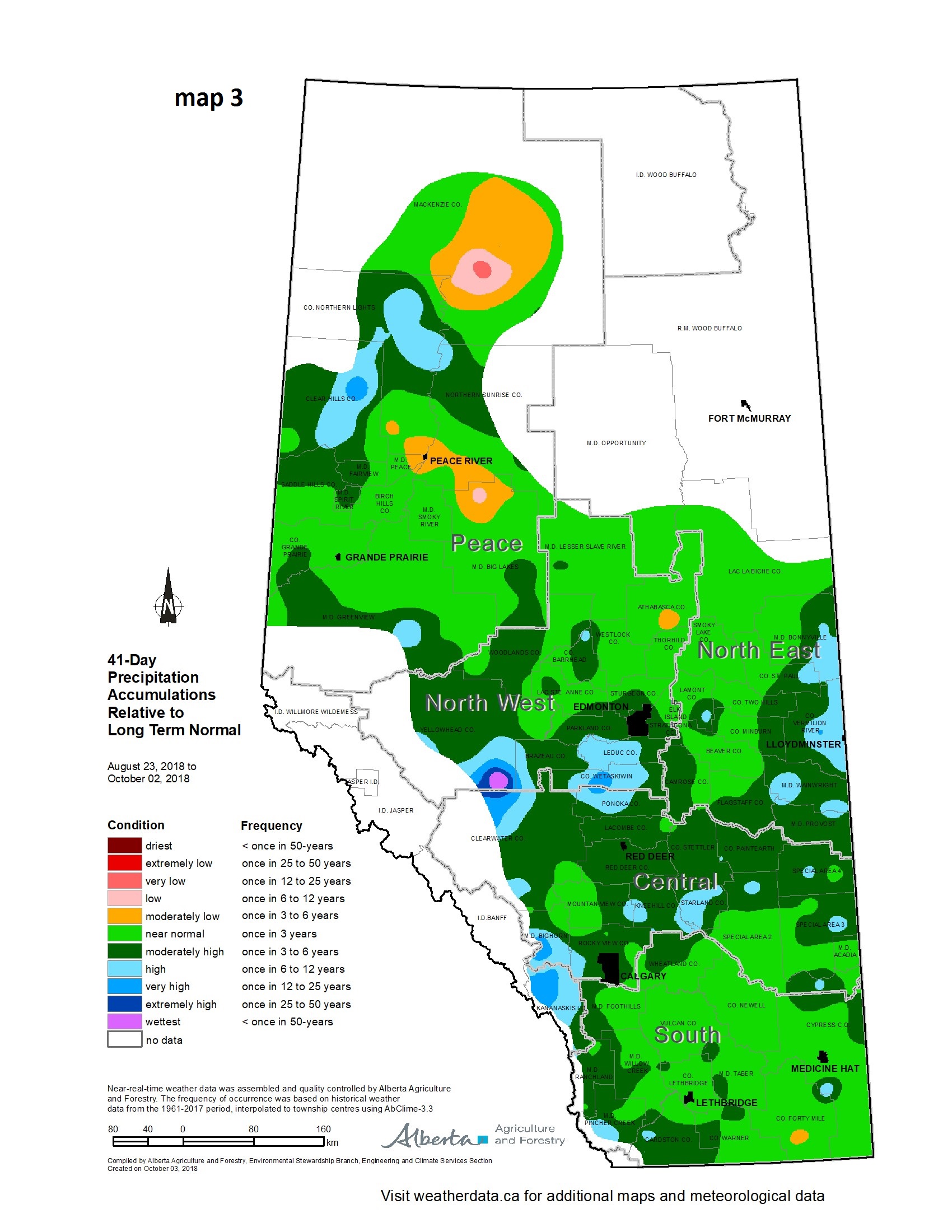
“Since the end of August, a change in weather patterns has resulted in most areas of the province experiencing at least near normal precipitation accumulations (see map 3),” say Wright. “A large area lying south of Edmonton and north of Calgary has seen above average accumulations with several pockets estimated to be this wet, on average less than one in six years. In contrast, a dry area is still persisting south of Fort Vermillion, just east of the Peace River near La Crete.”
Find more information at weatherdata.ca, Agricultural Moisture Situation Updates, or contact Ralph Wright, manager of the agro-meteorological applications and modelling section at 780-446-6831.
Contact:
Ralph Wright
780-446-6831 |
|