| |
Salinity Distribution within the County of Wheatland | |
| |
|
|
| |
|
|
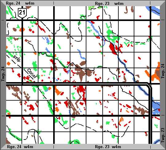
| | The County has 4 206 saline seeps which occupy a total of 13 401 ha (33 113 ac). The visibly saline areas have such high salinity levels that annual crops cannot be grown and forage crops have significantly reduced yields. Often the lands surrounding the visibly saline areas are also weakly saline, resulting in reduced yields especially for salt-sensitive crops.
Twp. 24 Rge. 23 W4M
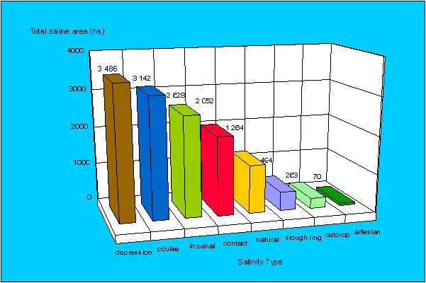
Salinity Type | Number
of Seeps | Area (ha) | Percent (%)
of Total Saline Area |
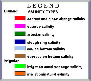
| Contact/slope change salinity | 1 278 | 2 052.27 | 15.3 |
| Uutcrop salinity | 173 | 263.18 | 2.0 |
| Artesian salinity | 18 | 70.02 | 0.5 |
| Depression bottom | 1 027 | 3 486.36 | 26.0 |
| Coulee bottom salinity | 345 | 3 142.43 | 23.5 |
| Slough ring salinity | 65 | 493.71 | 3.7 |
| Irrigation canal seepage salinity | 1 016 | 2 628.25 | 19.6 |
| Natural/irrigation salinity | 284 | 1 264.41 | 9.4 |
| Total | 4 206 | 13 400.63 | 100.00 |
Depression bottom salinity is the most common type (26.0% of the total saline area), followed by coulee bottom salinity (23.5%), contact/slope change salinity (15.3%), slough ring salinity (3.7%), outcrop salinity (2.0%), and artesian salinity (0.5%).
Total saline area by type
Please refer to Salinity Classification, Mapping and Management in Alberta for more information. |
|
| |
|
|
| |
For more information about the content of this document, contact Karen Raven.
This document is maintained by Laura Thygesen.
This information published to the web on February 12, 2004.
Last Reviewed/Revised on December 4, 2017.
|
|