| | Monitoring and Reporting | Actions
.
This area of focus includes ongoing monitoring, evaluation and reporting on soil moisture conditions, precipitation amounts and patterns, snowfall accumulations and air temperature regimes in the agricultural areas of Alberta
.
Monitoring and Reporting
Monitoring includes routine measurement of meteorological and agricultural parameters useful in developing adequate drought indicators. Many of these measurements are collected in near real time and are quality controlled. The quality controlled parameters are used to run weather analysis, soil water balance, and drought indices models that are interpreted to determine the start, intensity, extent, and ending of drought or excess moisture conditions. Some of these parameters are also used to produce weather based insurance products. The weather analysis and drought indices are summarized into regular moisture situation updates. In addition, AF’s Agro Climatic Information Service (ACIS) web site provides near real time meterological data from more than 387meteorological stations across the province and weekly maps provide up-to-date information.
The moisture situation updates use a combination of scientific drought indices to objectively and accurately determine drought severity, extent and duration. Combining indices provides a more accurate assessment of drought severity. AF will collect, analyze and distribute up-to-date information, publish regular reports and update maps and data on the ACIS web site. The combined information will help define development of any extreme conditions in order to guide appropriate and informed responses by government agencies and the agricultural community to existing situations. The moisture situation updates (available to the public) includes precipitation received and frequency of occurrence, soil moisture conditions, snow pack conditions, and temperature trends and regimes; and moisture situation updates are forwarded to the Minister and rural MLAs.
In addition to the moisture situation updates, other reports may include the following:
- Regional crop condition reports
- AEP Surface Water Reports
- Interpretation of impact, based on field information from municipality field staff for the affected areas concerning the following resources:
- surface water, dugout and reservoir supplies
- feed supply
- crop and pasture condition
- wildfire risk
- grasshopper levels
Alberta's weather monitoring capabilities are being continually improved by the expansion of AF’s Near Real Time (NRT) standard weather station network across the agricultural regions of the province. AF has also developed a state of the art data quality assurance and quality control program and weather data delivery system.
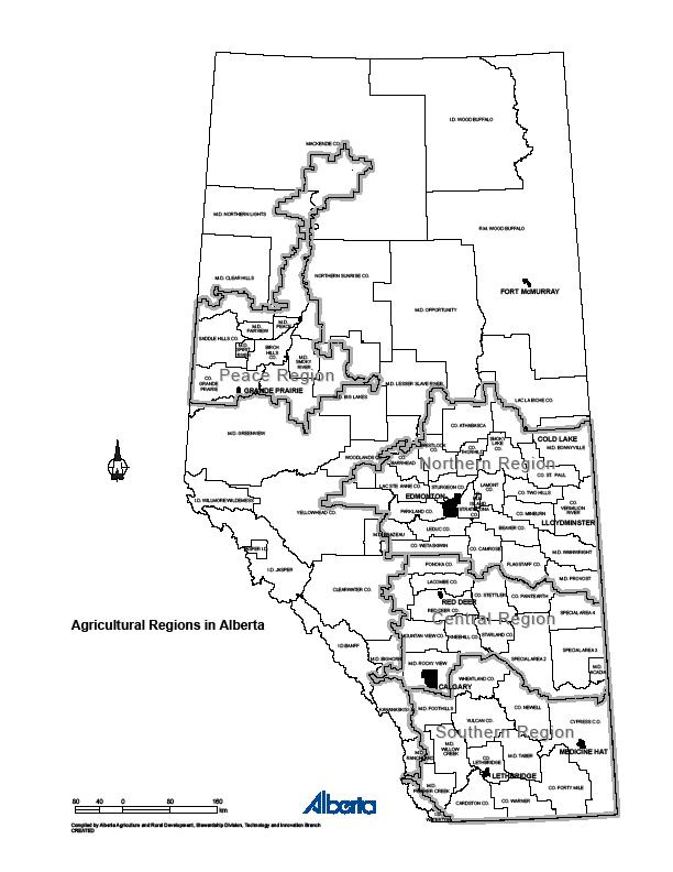
The following strategies describe actions in support of drought and excess moisture monitoring and reporting of information on a regional basis; the Peace, Northern, Central and Southern Regions as illustrated in this map:
Actions
| Action | Agent |
| Goal: Timely, Accurate Drought Monitoring. |
| Maintain and improve AF’s AgMet network and provide quality controlled weather and estimates of soil moisture to users in a form the can be readily used. | AF |
As of January 1, 2015, the following list of weather and soil parameters were being measured at AF weather stations:
� 222 stations with precipitation, temperature, humidity,
� 169 stations with 2 meter wind speed
� 147 stations have 10m wind direction and speed
� 34 stations have soil moisture and temperature (5,20,50 and 100 cm)
� 87 stations have solar radiation
� 13 stations have snow depth
AF also makes use of data from about 165 hourly NRT reporting stations located inside and outside of the agricultural area, as well as in the neighboring provinces. Data is available in near real time on the ACIS web site.
Additionally:
AEP operates and maintains approximately 90 permanent near real time Meteorological Stations, as well as numerous hydrometric stations and snow survey sites. | AF
AEP |
Water is stored in various reservoirs for licensed uses. Volumes available are regularly reported to stakeholders to help them make decisions. Other available resources include Advisories and Warnings, Maps and Data Summaries, Forecaster’s Comments, and the Water Supply Outlook.
See: Alberta River Basins website | AEP |
| Goal: Moisture Situation Updates for the Agricultural Region of Alberta |
Moisture Situation Updates for the Agricultural Region of Alberta describe current soil moisture and precipitation conditions. The updates include maps of recent precipitation patterns, snow pack accumulations, temperature regimes, soil moisture conditions and drought indices that all help to define the severity and extent of adverse moisture conditions across the province. Under normal conditions, the updates are generally produced regularly from May 1 to August 31, with monthly updates during the winter. As conditions become notably above or below normal, updates become more frequent and more detailed.
Moisture Situation Updates and related maps are sent to the Minister of Agriculture and Forestry and his rural caucus colleagues, as well as key AF and AFSC staff. These regular Moisture Situation Updates are also posted to Ropin’ the Web.
Each week, or when conditions change significantly, more than 40 new maps will be published to the ACIS web site allowing users to track conditions between moisture situation updates. The ACIS on online station viewer allows even finer resolution, allowing users to see what’s happening at any one of more than 380 stations in Alberta with data usually only a few hours old. | AF |
Indices – Maps are created using science-based drought indices to determine the level, extent, and duration of drought. Each index provides an objective, consistent approach to assessing the level of drought. The partners evaluate a variety of indices and then model and upgrade selected indices to suit Alberta's climatic conditions and meet its information needs. Using a combination of indices provides more accurate assessments of the level of drought. See Appendix 3 for more information on drought indices.
Severity maps – show the extent and severity of current conditions based on the values of several indices. These maps are produced year round, and are based on state-of-the-art drought science that is supported by a high quality meteorological network. | AF |
| Goal: Timely Release of Quality Controlled SSM and Precipitation Data to AFSC |
| Provide soil moisture and precipitation data to AFSC to facilitate timely payments under AFSC’s weather based insurance products. This information is used to make payments that are generated part way through a growing season and shortly after the growing season. | AFSC |
| Goal: The maps and data are available to help farmers with short and long-term planning and decision-making throughout the year. |
AgroClimatic Information Service (ACIS) is an interactive web tool that helps producers, farm consultants, and researchers create maps, obtain historical and near real time weather data, climate summaries and a wide range of maps that depict historical and current precipitation patterns, snow pack accumulations, soil moisture conditions and trends, temperature regimes and drought indices. The weather data and maps help farmers understand their climatic regimes and put current conditions, into perspective, thus helping them with long-term planning and decision-making.
Users can also view and obtain historical and near real time weather data from over 380 meteorological stations. The maps and data help farmers with their long-term planning and decision-making throughout the growing season. Additionally, AF quality controls data for AFSC precipitation-based insurance products.
AF’S current meteorological program, with increased station density and the addition of measurements like solar radiation, together with new data processing systems, have lead to enhanced model accuracy and reporting products and services providing the necessary support for superior drought preparedness and drought response decisions. | AF website Ropin’ the Web |
| Goal: AFSC Monitoring and Reporting |
| AFSC utilizes its network of field office staff, and numbers of pre harvest claims to assess drought severity. This information is used to deploy resources to affected areas and determine if there is a need for expedited processes to provide timely service to clients. | AFSC |
| Goal: Alberta Environment and Parks Monitoring and Reporting |
Near real-time reporting of water supply conditions are available to the public through Alberta Environment and Parks’s website. Maps and Data Summaries and Water Supply Outlooks and Forecasts are provided online. Hydrometric, meteorological, snow conditions, and reservoir and lake level data are continually updated.
AEP provides an Alberta Rivers: Data and Advisories Mobile Application to obtain the latest information about Alberta's rivers, including flood advisories and comments issued by Alberta's River Forecast Centre. | AEP |
|
|