| | Ralph Wright, manager of the agro-meteorological applications and modelling section with Alberta Agriculture and Forestry (AF), analyzes the data.
Synopsis:
Thursday, August 23 2018, marked the arrival of a cold arctic air mass that descended across the province, bringing an abrupt end to the long stretch of warm and dry weather that dominated the province over the past several weeks.
“In its wake, many widely scattered agricultural areas experienced an early fall frost (see map 1),” says Wright. “Through parts of central Alberta, temperatures dipped below -2 C for a few hours during the early morning hours of Saturday, August 25. The coldest temperatures were measured at the Ferintosh AGCM station, located 40 km south of Camrose, where the mercury dipped down to -2.4 C and stayed below the freezing mark for three to four hours.”
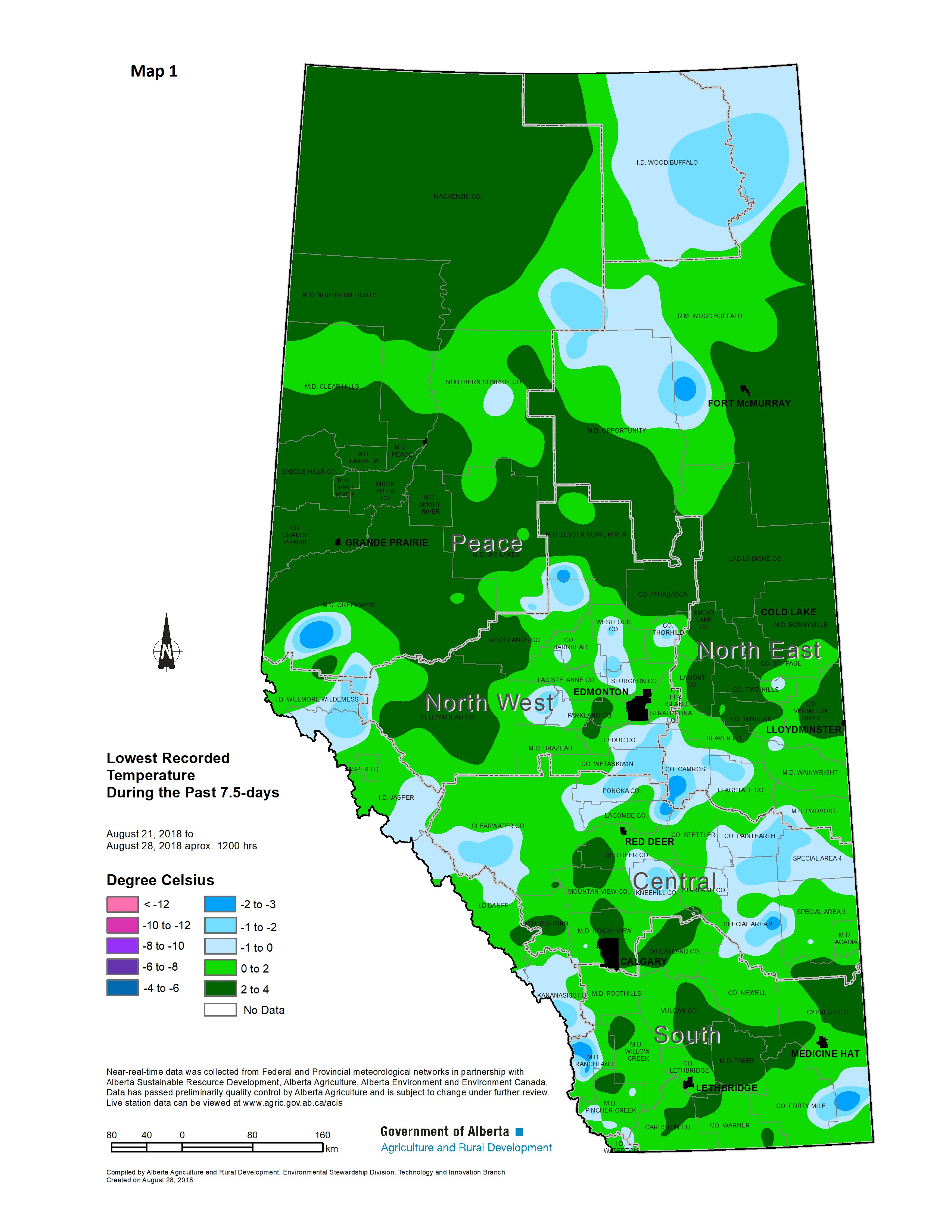
“Early in the morning of Tuesday, August 28, a second wave of frost touched down across a large area stretching from near Wainwright, down to about Oyen. The coldest air was measured at the Coronation climate station with temperatures remaining below zero for at least three hours, dipping to a low of -2.0 C. Notably, just south of Cypress Hills, the Lodge Creek AGCM station recorded a low -3.6 C with temperatures staying below freezing for about five hours.”
“Since cold air is denser than the surrounding air, and in the absence of strong winds, it drains across the landscape much like a layer of water would,” explains Wright. “It finds its way into low lying areas or is trapped by subtle surface features where it accumulates and pools. It robs the surrounding land of heat. As a result, local pockets of frost may be more or less severe than what is depicted on map 1. Fortunately, frost this early in the season can be very “hit and miss,” particularly following a long spell of warm weather where radiant heat from the land surface helps warm the surrounding air. In some cases, frost may only affect portions of fields rather than large wide spread areas. For an interesting article on frost behavior, read AF’s Protection Against Frost Damage.”
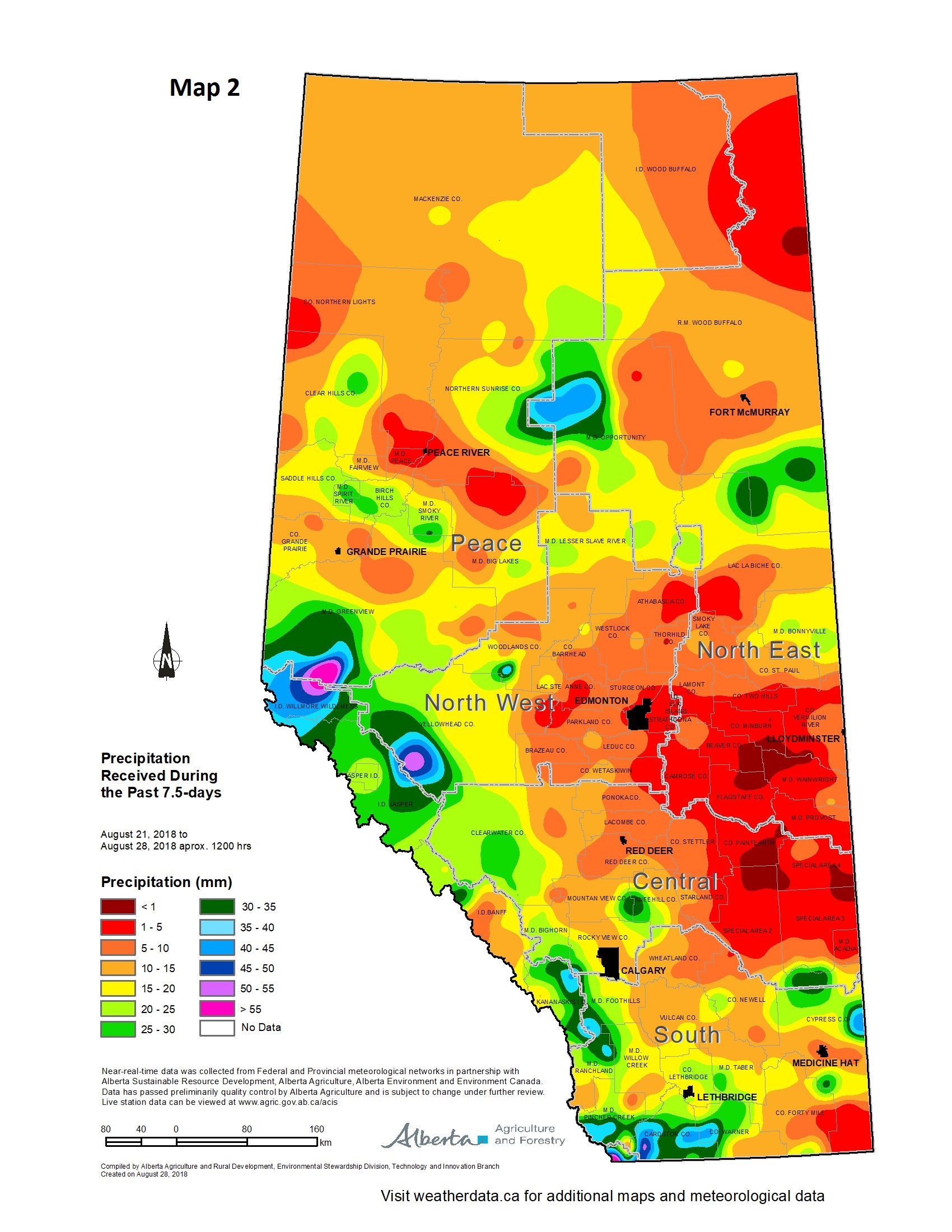
Wright adds that some much needed moisture came with the unseasonable cold. “Especially in southern Alberta where most areas received at least 10 mm of moisture, ranging to over 40 mm in and along the Milk River Ridge (see map 2).”
Find more information at weatherdata.ca, Agricultural Moisture Situation Updates, or contact Ralph Wright, manager of the agro-meteorological applications and modelling section at 780-446-6831.
Contact:
Ralph Wright
780-446-6831 |
|