| |
The Boreal Transition Ecoregion | |
| |
|
|
| |
|
|
| |
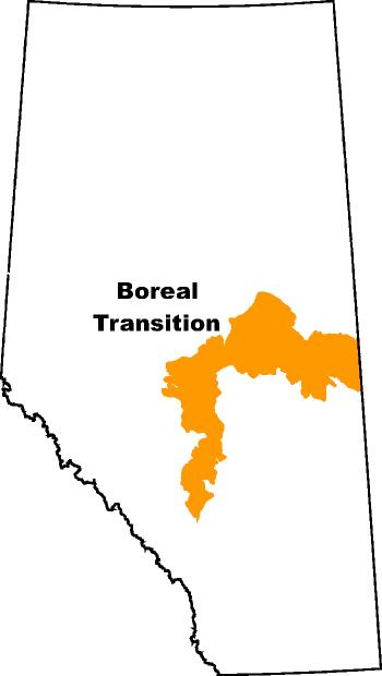 | This ecoregion located to the north of Edmonton and extends eastward to Saskatchewan. It marks the southern limit of a closed boreal forest and the most extensive land use is arable agriculture. It covers nearly 4 million hectares or about 6% of the total area of the province. The ecoclimate is classified as subhumid low boreal. Summer temperatures are warm (summer mean average is 14 degrees Celsius) and precipitation is moderate (450 mm annually). The region is associated with a number of small lakes, ponds and sloughs with the dominant drainage system being the North Saskatchewan River. Well to imperfectly drained Gray Luvisols and Dark Gray Chernozemic soils dominate this ecoregion.
Agricultural Ecoregion in Alberta |
|
|
| |
|
|
| |
Other Documents in the Series |
|
| |
The Peace Lowland Ecoregion
The Boreal Transition Ecoregion - Current Document
The Aspen Parkland Ecoregion
The Moist Mixed Grassland Ecoregion
The Fescue Grassland Ecoregion
The Mixed Grassland Ecoregion
|
|
| |
|
|
| |
For more information about the content of this document, contact David Spiess.
This document is maintained by Laura Thygesen.
This information published to the web on August 1, 2001.
Last Reviewed/Revised on June 19, 2017.
|
|