| | Introduction | About Geophysical Exploration | Landowners’ Rights | Side Notes | Appendices | Contacts
Introduction
The Farmers’ Advocate Office (FAO) has prepared this publication to provide information in response to general questions about geophysical exploration (also referred to as seismic operations) in Alberta.
This publication is intended to provide the surface owner or occupant with a brief synopsis of their rights regarding geophysical exploration on private and leased land.
About Geophysical Exploration
Geophysical exploration is a process of mapping the subsurface of the earth to detect the presence and position of petroleum and mineral deposits. Measurements are made using an energy source which is recorded by sensors (geophones) that are placed at specific locations and surveyed.
Exploration will use either an explosive energy source (dynamite) or a non-explosive energy source (vibroseis). When using an explosive source, shot holes are drilled to a depth of typically 6-15 metres and are loaded with explosives by certified technicians on the drilling crew. When using a non-explosive source, seismic vibrators are activated at ground level. Both techniques generate seismic waves, which are refracted and reflected back to the earth’s surface, where they are recorded using geophones.
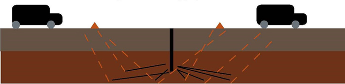
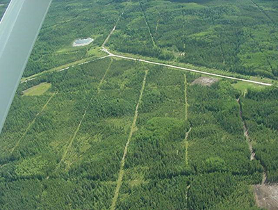
The simplest form of geophysical exploration is 2 dimensional (2D), which entails distributing geophones and source points along independent recording lines which traverse specific areas of interest. Two dimensional (2D) exploration provides subsurface information only for the area below the line at the surface. The source points and the geophones are positioned by a survey crew following a technical design, regulatory approval conditions, and landowner permit conditions.
Most operators are now opting for 3 dimensional (3D) geophysical exploration. In 3D exploration, a grid of source and receiver lines is set up over an area of interest. The 3D technique records numerous lines and stations at the same time, as opposed to a singular line as in 2D techniques. Because multiples lines are being recorded, the data from each source point is recorded over a large area beneath the 3D grid.
Spacing between the source and receiver lines will depend on the depth of the target zone. The stations and lines are closer together for shallow targets and farther apart for deeper targets. When designing a program for very shallow targets, the station lines could be as close as 2 metres apart and stations as close as 5 metres apart. A deeper target may have lines upwards of 400 metres apart and stations greater than 50 metres apart.
The receiver and source lines are usually kept as straight as possible, but they may meander slightly to avoid structures and other topographical features. When a geophysical permittee acquires a permit for 3D exploration, they will usually want the ability to move or offset source or receiver points from the original permitted locations.
3D geophysical crews typically require more personnel and equipment than 2D crews. Some crews will use a helicopter to move equipment around. This is especially beneficial in situations where vehicle access is an issue.
Landowners should be aware that even if there does not appear to be any crew activity in the vicinity of the equipment in the area, the equipment is still being used to record data.
As technology improves, some companies are now opting to incorporate time as a component of their surveys. This is known as 4 dimensional (4D) geophysical exploration. With 4D exploration, the survey is re-shot at regular intervals – typically annually, though in some cases as often as every six months. The licensee will generally apply for a longer geophysical approval for 4D exploration and negotiate re-entry conditions and additional compensation with landowners as necessary.
Landowners’ Rights
Notification
Notification must occur a minimum of 48 hours prior to the commencement of geophysical exploration, regardless of the energy source being used. The notification process is regulated through the Alberta Energy Regulator (AER).
As a minimum, the notification must contain the following information:
- the name of the permittee,
- a contact name complete with phone number, and
- a description of the energy source.
In Alberta, geophysical exploration is typically contracted from a resource company (licensee) to a permit company (permittee). A landowner may ask the permittee or the AER for the name of the licensee.
Negotiation
To obtain approval for a preliminary geophysical program, a licensee must submit an application to the AER. The AER is responsible for issuing a letter of authorization for an operator to conduct geophysical activity.
The authorization from the AER does not grant access onto private land. The licensee must acquire written consent from the landowner (or a person authorized by the landowner) prior to conducting any geophysical operations on private land.
If entry is refused by the landowner, the operator has no appeal and geophysical activity cannot occur, except in the case of carbon capture and storage. The maximum fine for conducting geophysical exploration on private land without landowner consent is $25,000.
If a company wishes to undertake geophysical exploration on your land, the process will begin when you are approached by a permit agent working on behalf of the licensee. If you do not understand any details of the program, you should not hesitate to ask the permit agent questions.
It is entirely up to a landowner to negotiate the terms of the contract agreement to ensure their needs are protected. A standard permit form entitled Permit to Conduct Geophysical Operations was developed by the Canadian Association of Geophysical Contractors, in conjunction with the FAO, the Canadian Association of Petroleum Producers, the Explorers and Producers Association of Canada, and Alberta Environment and Parks (Appendix A). A landowner is under no obligation to use any other form, and the landowner has the right to refuse entry over dissatisfaction with a licensee’s permit form. A landowner has the right to capture all commitments and agreements as an appendix to the permit form.
The permit agent may have certification through Enform’s Geophysical Permit Agent Program. Although this program is not mandatory, it is highly recommended for all permit agents. A landowner may request that a permit agent’s certification number be provided on the permit form.
The FAO strongly recommends that landowners use the Permit to Conduct Geophysical Operations for all exploration occurring on their land. The agreement provides clauses to help recognize both the landowner’s interests and the licensee’s needs. Both parties may make changes to the permit form to help suit their particular circumstances.
The permit agent will provide a map of the proposed access routes and program lines. A licensee will usually want some flexibility within the permit to move or offset source points from the original permitted line. A standard clause on the permit form includes a statement providing permission to move, shift, offset or delete lines. Providing some flexibility will enable the operator to move from line to line or to cross fence lines and gates, which helps in the execution of their program. The landowner may want to provide input on the route to follow fence lines or avoid shelterbelts.
Required setback distances for source points from infrastructure are outlined in AER Directive 2006-15 (Appendix B). Reduced setbacks to certain structures are permitted if the licensee acquires written consent from the owner of structure. Note that if your property is designated as a Provincial Historic Resource, ministerial approval must be in place prior to any land disturbance or seismic testing.
The licensee will typically obtain a right-of-way that is slightly wider than the line to help accommodate the equipment. The permit will specify the width of seismic line, which is typically 5 metres, but will vary depending on the type of terrain. Negotiations should also determine the manner in which brush, trees, or snow may be cleared from the line.
Owners of buried facilities such as pipelines, telephones, or power will locate and mark the positions of their facilities with lath or stakes so that the source points for the geophysical exploration are placed at the proper setbacks. The marking of the buried facilities follows the Alberta One-Call process. Landowners that have unmarked or buried facilities should mark the path and depth on the permit sketch diagrams.
Landowners should ensure they fully understand the traffic and access routes that will be utilized. Trucks, quads, skidoos, buggies, or tracked vehicles may be used during the program. For access, it is beneficial for the both the landowner and the licensee to minimize disturbance. To help reduce detouring, the permit agent may request permission to cut fences, but consideration should be made of any livestock in the area. The crew is responsible for repairs and may opt to contract the work to the landowner. The permit should also outline a plan for clean-up and disposal of any trees or brush that must be cut to accommodate exploration.
A discussion on timing is an important component of the negotiation considering the seasonal nature of agricultural operations. Geophysical programs can occur at any time of the year, but they generally depend on ground and environmental conditions.
The permit should stipulate the approximate dates the permittee plans to access the property and when they estimate the program will be completed. Since larger areas can be recorded with 3D exploration, the equipment stays on the ground longer compared to 2D exploration.
A landowner may request that they be notified before the permittee enters any part of the property for the commencement of operations, or for each phase of the operation. The phases are generally surveying, locating buried facilities, drilling, recording, and clean-up. Negotiations should specifically recognize a timeline for
clean-up and restoration.
After the recording is complete, the geophysical crew will pick up and remove their equipment, survey markers, lath, and refuse. All garbage and toilet facilities should be cleaned up to the landowner’s satisfaction.
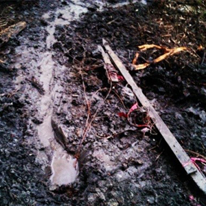
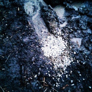
For programs that utilize explosive energy sources, each shot hole must be temporarily abandoned immediately after the drilling and loading of the shot hole. The shot hole must be permanently abandoned after detonation. To permanently abandon shot holes, the permittee will insert an approved hole plug approximately 1 metre below the ground surface. Above the plug there will be 40 centimetres of an approved sealing product, such as bentonite, and then 60 centimetres of drill cuttings up to the ground surface.
In areas prone to flowing holes, a landowner may desire to have the entire shot hole plugged with a sealing product. In certain areas of the province, the AER has specific conditions to manage the potential for flowing holes. The minimum standards for abandoning a shot hole are in the Exploration Regulation and associated AER Directive. The method of abandonment should be discussed when the permit is being negotiated.
The permittee is responsible for restoring the ground surrounding the hole to as close as possible to its original condition. Generally the cuttings are placed back into the hole with remaining materials spread level around the hole. However, since drill cuttings will naturally contain clay, spreading them around an abandoned shot hole can be detrimental to vegetation.
A landowner can specify that they want nothing left behind after the abandonment is complete. Using a containment device to catch drill cuttings when the shot holes are drilled makes cleaning up in the vicinity of the hole much simpler. The holes should be covered and tamped to an extent that there would be no impact to livestock or general use in the area. The landowner’s preferred approach to managing drill cuttings can be discussed in the negotiations with the permit agent and then documented in the agreement.
Before the drilling crews leave the location, the permittee must ensure that an approved source point permit tag is affixed in a readily visible location near each source location. The permit tag must contain the number of the exploration approval for the program and the permit number of the operator. The source point permit tag is to be affixed, where possible, not more than 10 metres from each centre source point.
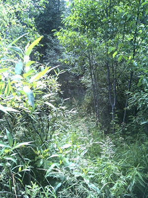
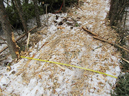
Receiver line regrowth after 1 year
The matter of compensation is managed entirely by the landowner and the operator, as there is no legislation governing the amount or method of payment. It is common practice for geophysical operators to offer compensation that is equitable to all landowners who are affected by a specific program. If compensation negotiations are unsuccessful, the owner of the land may refuse entry. Generally, most operators pay access fees within 30 to 90 days following completion of the geophysical program. However, a landowner may request prepayment as part of their negotiation.
A landowner will be paid damages for any impacts that occur beyond the normal wear and tear expected from the geophysical program. The licensee will typically anticipate the payment of some damages, particularly if they are working through cropped land. Examples of other potential damages include rutting, compaction, cut or broken fences, flooding from flowing holes, impacts to livestock, damaged culverts, or spilled equipment fuels.
It is highly recommended that the landowner and the permit agent inspect the land surface prior to signing a damage release, so that any outstanding issues can be identified and addressed. Since the permit agent is not present during the program, he or she may be unaware of damages.
The discussion on damages will occur shortly after the program completes. The FAO recommends that any agreements coming out of this discussion be put in writing. It is important to be specific about the types of damages and time period being covered, as a licensee will not want to be held responsible for specific losses for an indefinite period of time. The licensee will want to pay the program damages and then be released from that specific damage. Once a damage release form is signed for a specific loss, there can be no future claim for that item. Having the landowner sign damage release forms is not required by legislation, but is considered to be a standard practice to “close” the permit agreement.
There may, however, be damages that are unforeseen at the time of signing the damage release. By law, the licensee is still responsible for damages unforeseen at the time of signing the release, such as craters (the area around a shot hole subsiding) or flowing holes. If you spot a crater or flowing hole after a geophysical program has completed, document it and report it to the permit agent as soon as possible. Good communication helps both parties. Obtaining payment for unforeseen damages becomes more difficult as time passes. Keep all your records and provide them to future owners of the property.
When a flowing hole occurs, regulation recommends that the operator confine the flow to the aquifer of origin. A flowing hole can be converted to a water well, but this process must be completed in accordance with regulation. Once the conversion is complete, the operator is no longer responsible for the hole, as it is no longer considered a shot hole.
If a shot hole caves in and creates a cratered hole or release of water, the licensee is responsible for present and future claims. If the licensee has been merged, amalgamated or taken over by another company, the liability goes to the new company. Landowners should be aware that no orphan program exists for cratered or flowing holes; this means that if the licensee no longer exists when problems arise, the landowner has no recourse.
A landowner may opt to have an arbitration clause on damages written into the original permit. Arbitration is an expensive process that produces a binding third party decision. It should be a last resort in the event of a dispute over damages. The AER may facilitate a discussion about damages to try to find a resolution between the landowner and the licensee. For more information, please see EnerFAQ: All About Alternative Dispute Resolution at www.aer.ca.
- Inspection and Supervision
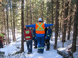
Before geophysical exploration occurs, a landowner should take photos of the property that could potentially be impacted by the activities. Landowners are encouraged to be proactive in monitoring the geophysical exploration occurring on their property to ensure the conditions communicated to the permit agent working for the licensee are followed by the permittee. Of course, this supervision should be collaboratively arranged with the permittee to ensure that the proper safety precautions are followed.
After the program is completed, the landowner and permit agent should plan an informal inspection of the lands before a damage release is signed off. The landowner should take a camera on the inspection to document any issues that are spotted. It is preferable to complete the inspection under non-frozen and snow-free conditions.

@istock.com/Binoe
If you want to be more informed about the construction, operation and maintenance of your water well prior to geophysical exploration occurring, the FAO highly recommends attending a workshop from the Working Well Program, which is a collaborative effort of Alberta Environment and Parks, Alberta Agriculture and Forestry, Alberta Health, the Water Well Drilling Association, and Alberta Health Services.
If there are concerns about the well’s ability to withstand geophysical exploration, the landowner has the right to refuse entry.
The licensee and permittee must abide with the setback distances outlined by the AER Directive 2006-15 (Appendix B). Regulations state that dynamite source points must be a minimum of 180 metres from a water well. However, a reduced distance of a minimum of 64 metres is permitted with the consent of the landowner. Acceptance of a reduced setback distance does not preclude a landowner from a claim if the water well is disrupted by geophysical activity.
The AER does not require water wells to be tested, but it is best practice in the geophysical industry to require water well testing before and after a geophysical program is completed. Appendix C provides the standard form for pre and post activity testing for water quality and quantity.
If a landowner believes that geophysical activities have disrupted their well, they should also contact the licensee immediately. If negotiations with the licensee are unsuccessful, the landowner should also contact the AER at 1-855-297-8311 to have an investigation completed. If the concerns cannot be resolved, the landowner may apply for compensation under the Water Well Restoration or Replacement Program (WWRRP). To be eligible for compensation under the WWRRP, the well must be completely repaired or replaced, and all receipts must be attached to the application form. Funded through industry levies, this program is designed to restore a well to the previous condition, not to make improvements on a former system. For more information, please contact the FAO.
Side Notes
Information for Disposition Holders
An operator must obtain approval from the Minister of Alberta Environment and Parks (AEP) to conduct geophysical activities on Crown land. Once the exploration approval is granted, the operator will seek written consent from the disposition holder.
Under the Exploration Dispute Resolution Regulation, any disputes that arise related to operational or land use concerns can be reviewed by a Local Settlement Officer (LSO) with AEP. Mediation and facilitation will be attempted and, if unsuccessful, the LSO will make a determination. Policy dictates that the timeline for reaching a facilitated agreement or LSO adjudicated determination is 10 working days. The outcome is considered an “LSO Decision” regardless of the manner in which it was determined.
Either party may seek a review of the LSO’s decision by making a request to the Review Committee. The Review Committee may make a number of decisions. They may also seek to facilitate an agreement between the two parties. It should be noted that the decision of the LSO is in effect until such time as the Review Committee reaches a decision. The Review Committee should render a decision within 10 working days and notify the parties in writing. The decision of the Review Committee is binding.
Road Allowances
Historically, it was common for geophysical exploration to occur on road allowances. A licensee may opt to use road allowances if entry is refused to private land.
Road allowances in Alberta are managed at the municipal level. Some counties allow road allowances to be leased to private parties, including farmers and ranchers. Permission for exploration on developed road allowances is granted through the AER, and regulation requires that notice be provided to the relevant municipality.
If the lessee of a road allowance and a geophysical operator are unable to reach a negotiated agreement, the operator may conduct geophysical operations on the leased road allowance 48 hours after giving written notice to the lessee.
Once an operator enters the leased road allowance, repairs must be made to any fences that are broken or altered as a result of the exploration activity. The operator must also take all necessary measures to prevent livestock from straying or being injured. They are also obligated to pay for any reasonable damages to the lessee arising from the exploration.
Leased Land
There are unique considerations for situations where an agricultural lease is in place between a landowner and a tenant. Unless it is otherwise stipulated in an agricultural lease agreement, the lessee of a property may not provide authorization for geophysical exploration without the authorization of the landowner.
To avoid and minimize conflicts, the FAO recommends having a clear agricultural lease agreement that speaks to a division of the entitlements and obligations relating to geophysical exploration.
Generally, the landowner:
- has exclusive right to say yes or no to entry,
- receives payment for entry, access and recording, and
- ensures that the lessee has input on program details such as access and timing.
Generally, the lessee:
- is contacted by the operator via the permit agent during the negotiations,
- maintains the option of open discussions with the owner of the land in the negotiations with the permit agent, and
- receives payment for crop damage and inconvenience.
Particular concerns brought forward by the tenant to the landowner should be reflected in the permit. Any conditions agreed to by the landowner should be communicated to the tenant.
Enforcement and Dispute Resolution
The AER administers the Geophysical Regulatory Enforcement Program, which assists in resolving issues and concerns between the geophysical industry and municipal districts, counties, special areas and landowners. Geophysical crew inspections are conducted on an ongoing basis as part of the regulatory enforcement program to ensure compliance with the legislation and associated regulations. If an infraction is identified through a crew inspection or a complaint, various levels of enforcement action may be imposed, including a monetary penalty.
This program also assists landowners with geophysical-related inquiries and concerns associated with exploration activity. The AER may investigate landowner concerns such as water wells, structural damage, permit disputes, surface damages, trespassing, flowing or cratered shot holes, livestock damages, and other miscellaneous inquiries.
Geophysical inspectors are presently located in Edmonton, Red Deer and Drayton Valley. This service can be accessed by contacting AER. The information received will be forwarded to an inspector who will respond to the inquiry. An unbiased field investigation may be initiated in an effort to work with both the complainant and the operator to resolve the conflict.
Appendices
Appendix A – Permit to Conduct Geophysical Activities
Appendix B – Exploration Directive 2006-15
Appendix C - Guidelines for Water Well Test Evaluations for Seismic Programs
Contacts
Farmers’ Advocate Office
Alberta Agriculture and Forestry
#305, 7000-113 Street
Edmonton, AB T6H 5T6
Phone: 310-FARM (3276)
Fax: 780-427-3913
Email: farmers.advocate@gov.ab.ca.ca
Twitter: fao_alberta
Facebook: Farmers’ Advocate Office of Alberta
Alberta Energy Regulator
Suite 1000, 250-5th Street SW
Calgary, Alberta T2P 0R4
Phone: 1-855-297-8311
Website: www.aer.ca
Email: exploration@aer.ca
Canadian Association of Geophysical Contractors
#1045, 1015 Fourth Street SW
Calgary, AB T2R 1J4
Phone: 403-265-0045
Fax: 403-265-0025
Website: www.cagc.ca
Email: info@cagc.ca
Note: All images have been provided by the Geophysical Steering Team unless otherwise noted.
Source: Agdex 878-5. Revised September 2017. |
|